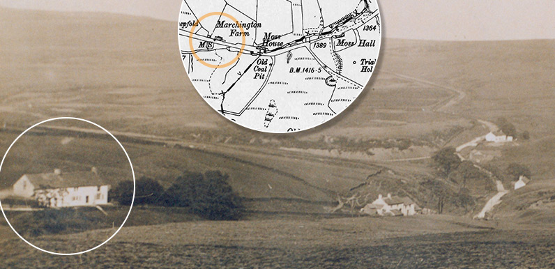
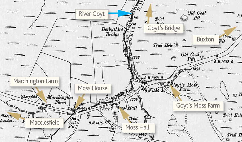
The circled house is Marchington Farm. The next building is Moss House. Further along on the right is Moss Hall, and lastly Goyt’s Moss Farm, which now serves as a Rangers’ centre and public toilets.
Today, the lane running from right to left leads to Errwood Reservoir.
Three of the houses were demolished after Stockport Corporation purchased the land following the death of Mary Grimshawe – the last of the family who had lived at Errwood Hall – in 1930. Even though they lay some distance from the planned construction of the twin reservoirs to the north. Rob writes:
The farms were referred to by my father’s generation as they had long memories handed down. Goyts Moss wasn’t prime land by any stretch of the imagination but it wasn’t the moorland that we see today.
The family, along with Swindells family, scratched out a living by small-holding, along with digging out coal – bagging it and selling it in Buxton, along with a stone quarrying business.
The family moved on after the 1851 census due to the hard living, dispersing around Chapel and Buxton, and down to Aston in the Birmingham area as they had a link with supplying stone there, and ended up running a road construction business given their involvement in stone pavers.
Humphry Marchington, who lived at Castage farm for a period and had a side-line on a coal seam near the farm, also did work for the tramway on the other side of the valley.
The tramway Rob mentions must have been the Cromford & High Peak Railway.
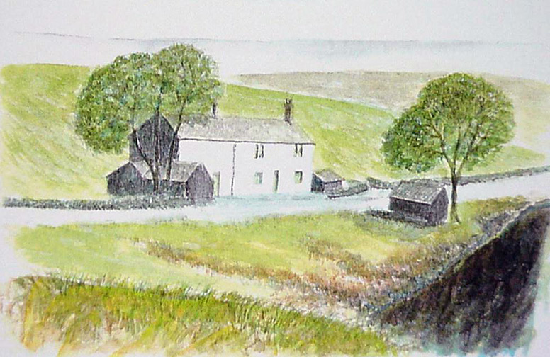
I’ve managed to find photos and some information on three of the four farmhouses: Marchington Farm, Moss House & Goyt’s Moss Farm. But very little on Moss Hall, apart from the illustration below which may show the farm house, although I’m not 100% sure.
Rob goes on to say;
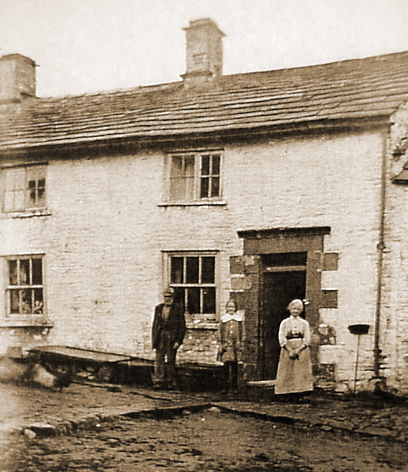
In the photo of the three houses (see top), if you’re coming down from the Cat and Fiddle, Marchington Farm is the first house. Next on the left is Moss House, which was the home of the Swindells family who are featured in the photo standing outside it (above left).
Further on – as you get to the dip and then slightly climb the hill towards Buxton – on the right is Goyt’s Moss Farm. This, according to my research, was a much older building held by my family and was in such poor condition that they moved to Marchington Farm, and Goyt’s Moss Farm was rented out to others pre-1841 census.
I think Rob may be confusing Goyt’s Moss Farm with Moss Hall. Moss Hall was the third building along the lane. Goyt’s Moss Farm was the last of the four farmhouses and is the only one to have survived (although probably rebuilt), serving today as a Peak District Rangers’ hut and public toilets.
Today all that remains of Moss Hall is a small area of flat ground. I’ll update this page if I manage to find any more information.


Can anyone tell me anything about the feature marked on the O/S map as ‘Jacobs Cabin’, NW of Derbyshire Bridge?
I just came across a mention of Jacob’s Cabin in John Barnatt’s 1984 Archeological Survey of the Goyt Valley. He describes it as a shooting cabin and adds; “Stone footings of a square shooting cabin. This is marked on the 1881 Ordnance Survey map (surveyed 1870-72), the first available map to show such detail.”