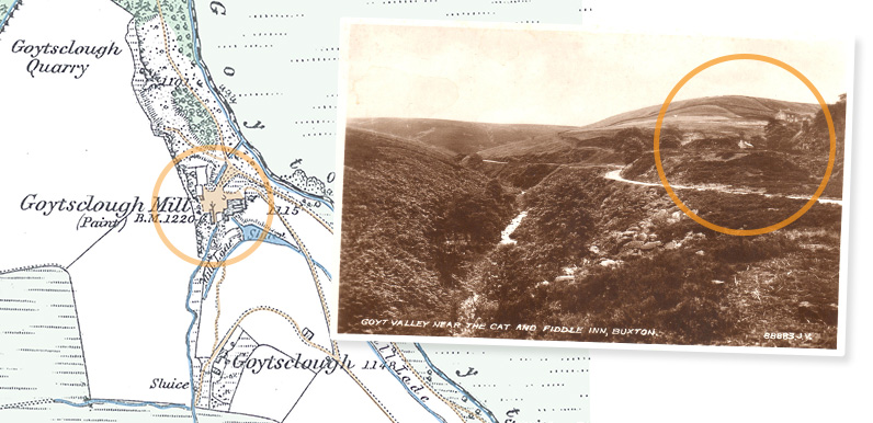
Above: The photo was taken from the slopes surrounding Goytsclough Quarry, looking south along the road to Derbyshire Bridge.The River Goyt runs along the valley to the left. A mill lade flowing from the river along the hillside supplied water to the giant waterwheel....
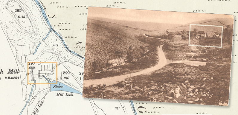
Above: The circled area of the postcard includes the ruins of the paint mill, as well as Goytsclough Farm high on the hillside, and the paint mill cottages. Zooming into the ruins of the mill seems to show an area of stone walling which I think may have housed...
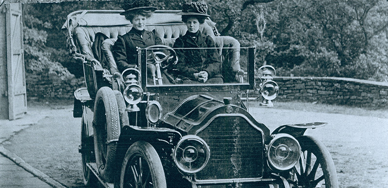
Above: I think these two ladies may have been servants at Errwood Hall, occupying a similar role to Irma. They both seem to be dressed in in funerial black. I wonder what the story is behind the photo. I would guess it would haver been taken around 1910 – some...
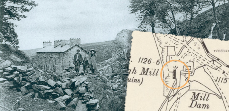
Above: The cottages at Goytsclough would probably have housed the mill manager’s family. I’ve just created a ‘then & now’ fade featuring one of my favourite views of the Goyt Valley (see below). The photo must have been taken around the end...
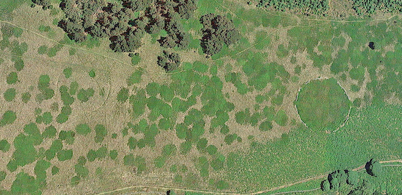
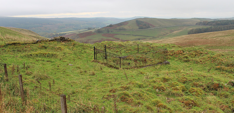
Above: The stone-edged circle on the right was fairly easy to spot from the Google Earth satellite image. But the one on the left has virtually vanished from the landscape. The OS co-ordinates are 005752. Any ideas on what they might once have been would be much...
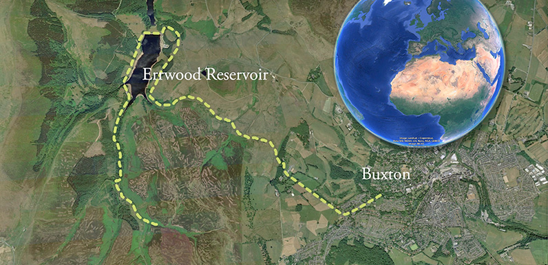
I chose the 8-mile circular walk from Buxton to Errwood Reservoir to create this Google Earth test as it’s one of the most popular – and longest – on the site. Please let me know if you enjoy it, or have any suggestions for making improvements....
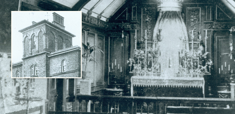
Above: The Grimshawe’s Catholic chapel was housed in the top floor turret at Errwood Hall. A light kept burning throughout the night was said to be visible throughout the valley. Above: Click to enlarge the press clipping. My thanks to Mike for sending this...
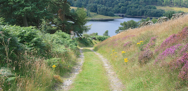
Above: Old Goyt’s Lane now vanishes beneath the waters of Errwood Reservoir. But in Vera and Rolands’ day this attractive walk would have ended in the picturesque hamlet of Goyt’s Bridge. It’s poignant to imagine the two lovers looking across...
Above; Don asks whether anyone knows what might once have been here, at the junction of the Long Hill road and Goyt’s Lane. I’ve recently moved back to Buxton, which is the reason for the recent flurry of posts as I try to catch up with all the projects...
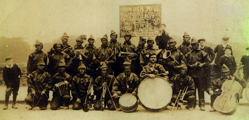
Above: Elaine asks about this wonderful photo of the Gunpowder Mill band which must have been taken in the early 1900s – or perhaps even the 1890s. Elaine writes to say; I have recently revisited Goyt Valley for the first time in over 30 years and will not leave...