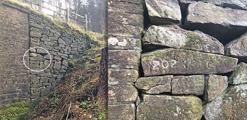
Above: The numbers are carved on a stone to one side of the old bridge near the bottom of the Bunsall Incline.
I had an interesting comment this week from Liam, asking whether I knew anything about what looked like an additional set of Joe Brown’s Numbers, carved by the bridge near the bottom of the Bunsall Incline.
He posted the question on a page about Joe’s orienteering challenge (click to view). Joe Brown was a world-famous mountaineer who worked at White Hall Outdoor Centre in the 1960s.
I assumed he must have meant the numbers on the nearby tunnel that passes under the Incline. But it seems this is a completely different set of numbers, and not part of Joe’s series of 20 clues scattered around the Goyt Valley.
The numbers appear very similar to Joe’s and read 202 x 970. Most clues are map co-ordinates, but those marked with an x between the three figures are compass bearings and distance in yards. Liam takes up the story:
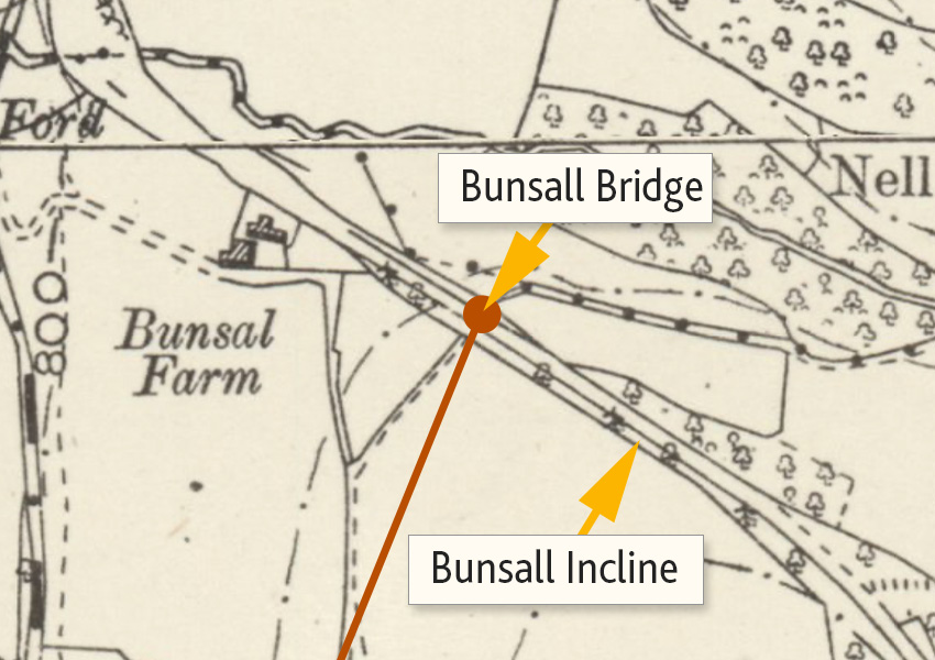
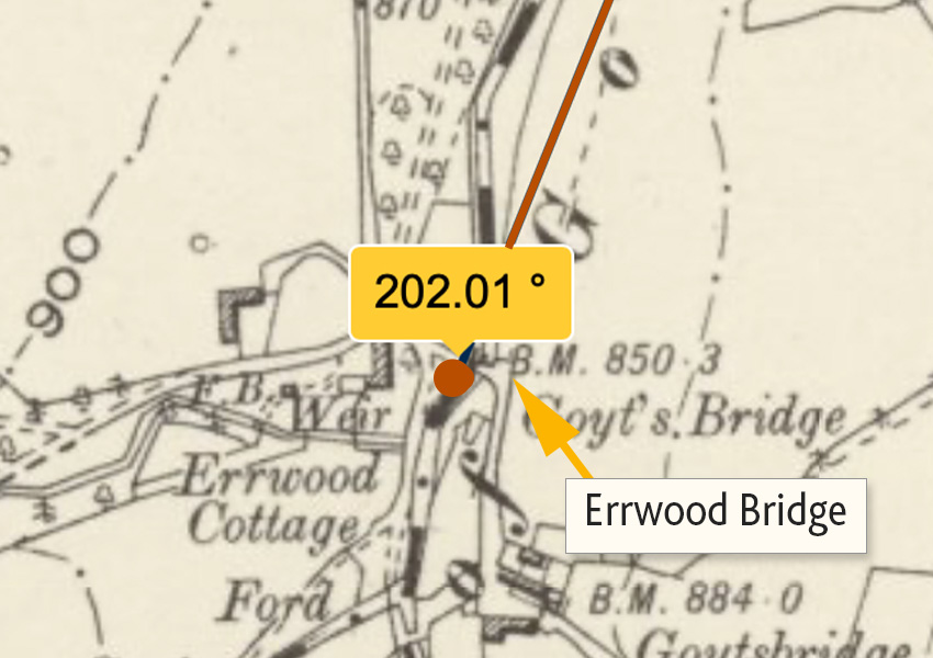
I’ve plotted these to the middle of Errwood Reservoir, but when overlaid on an old map it seems to point to Errwood Bridge in Goyt’s Bridge. Sadly we’ll never be able to check that out now so any route is broken here. I’d love to know if anybody knows anything about these additional numbers or has found any more.
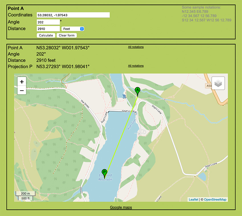
Above: Liam used a website for Geocache enthusiasts to plot where the figures point to – in the centre of Goyt’s Bridge, which now lies under Errwood Reservoir!
Errwood Reservoir was flooded in 1967 – which was after Joe started working at White Hall. So he would have been able to walk across this part of the valley to carve the next clue in the series.
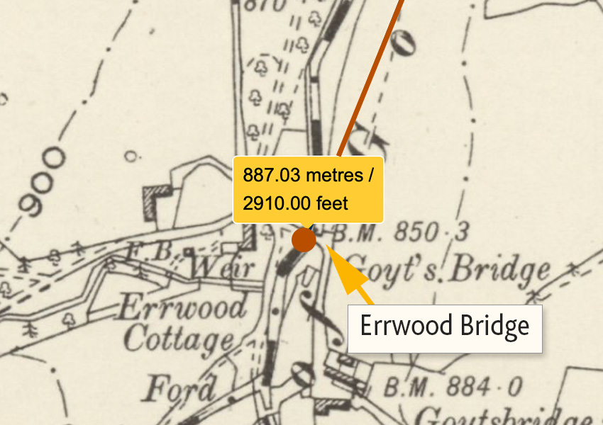
I used the National Library of Scotland’s wonderful mapping resource to see if I could get an accurate fix using the 202 x 970 reference. This has OS maps going back to the late 1800s which show Goyt’s Bridge in some detail. It also has tools to measure distances as well as compass bearings.
The co-ordinates confirm that the next clue must have been carved on Errwood Bridge, which once spanned the River Goyt in the heart of Goyt’s Bridge.
Forgive me for stating the bleedin’ obvious, but this means the Bunsall Incline clue must date to before the 1967 flooding of Errwood Reservoir. And since all of Joe’s existing series of 20 clues are in situ, and none have been lost beneath the waters, this course must have been created after 1967.
Liam has found another similar set of carved numbers at Shining Tor. These point towards Cats Tor, but despite looking, he hasn’t found any further clues at that point. Perhaps these two clues are part of the same, earlier challenge. But it’s odd that no others have been found.
If anyone knows of any other clues in the area, please do leave a comment below.
