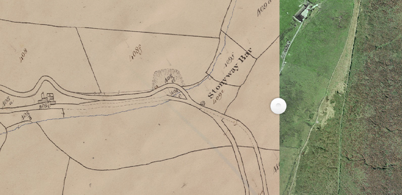
Above: The 1849 tithe map clearly shows the newer Stonyway Bar toll house at the junction of the two turnpikes. And the old one to the left, which appears to have been converted to a house.
Alec has discovered a wonderful website that reveals a lot about the history of the Cheshire side of the Goyt. Including the position of the second Stonyway Toll House. The site is called ‘Cheshire Tithe Maps Online‘.
It’s very simple to use. To view Stonyway Bar, simply enter ‘Stake’ in the ‘Search for a place’ at top left and select ‘Stake Farm Macclesfield Forest’ from the results. You can then zoom in and out, as well as pan around to view other areas of interest.
The window splits into two halves – the 1849 tithe map on the left and an OS map (or aerial view) on the right. Simply drag the central button to the left or right to widen the view on either side. You can also change the maps that are displayed in either window using the options under the search field.
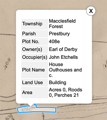
Above: Clicking on any area reveals information on each individual plot.
It shows that in 1849 the first Stonyway toll bar was now a house with outbuildings, occupied by John Etchells and owned by the Earl of Derby.
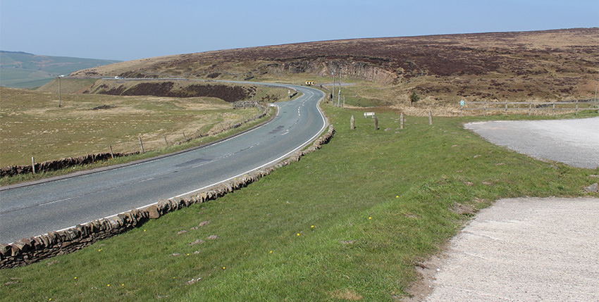
Dragging the green slider shows where the second toll bar once stood. It’s further away from the cafe than was thought. But it makes sense looking at the landscape today (below).
So that’s the mystery of the two Stonyway toll bars cleared up! But the site provides a wealth of fascinating information. And more than enough for another few posts!
Dragging the map further north, you can see that Errwood Hall has yet to be built. The owner is shown as Samuel Grimshawe. And we know he purchased the estate in 1832. It’s always been thought that building work started in the early 1840s. But this tithe map is dated 1845. So that’s clearly wrong.
Castedge Cottage and Shooters Clough Cottage are both shown on the map. As is Errwood Cottage to the east. But unfortunately nothing of Goyt’s Bridge, as this lies mainly on the other side of the Goyt – in Derbyshire. Which is a great pity.
More to follow!
Any idea where the ‘poor house’ would have been in 1851? The gamekeeper to the Earl of Derby lived there with his family.